South Korea: Cycling Four Rivers Trail from Seoul to Busan
Louise George
Our ride over this route took 10 days, covering 680 kilometres. We rode in late autumn; November. Rather than write a day by day blog, I decided to give an overall picture, both in the text content of this blog and in the grouping of pictures, rather than a chronological account, because anyone riding this route will be of varying abilities, have different amounts of gear and may choose to take a different amount of time. At the end of the blog I have listed our travel in days and distances.
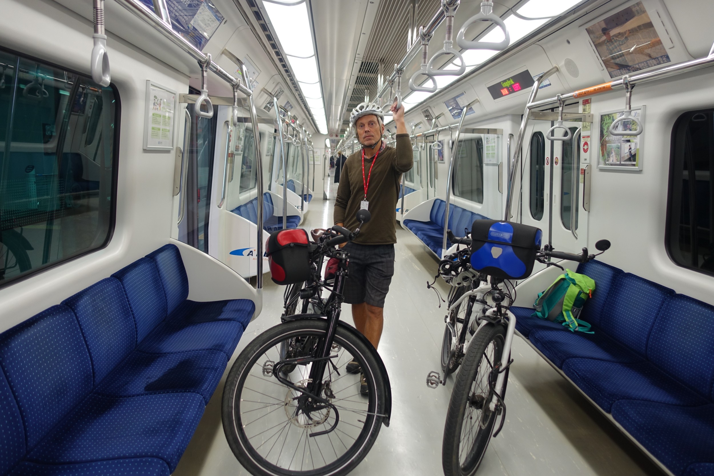
We had five days of sightseeing in Seoul. The official starting point was Ara West Sea Lock and we didn’t want to ride there. We had established that bikes could be taken on the trains, only on the weekends and only in the first and last carriages that would be identified by a bicycle icon. It was Sunday and we envisaged the train and 40 km ride would only take the morning, leaving the afternoon for more sightseeing back in the city. I highly recommend you plan to enjoy just the cycling activity because in effect, that is all we achieved that day.
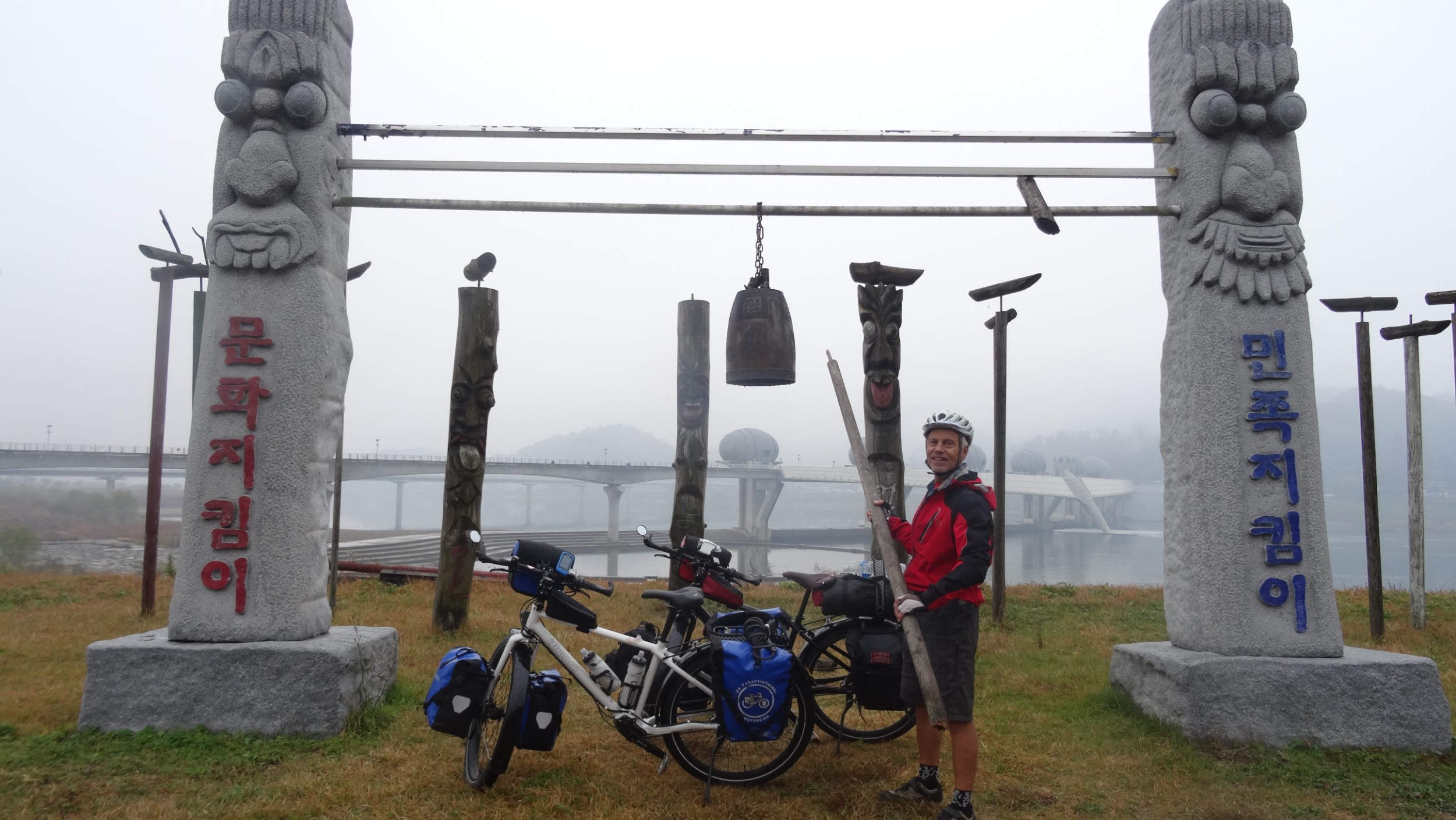
We decided to get the express train that goes to the airport from Seoul City Station as that train passes through, and also stops at Cheongna International City, the nearest station to the start of the trail. This journey was for us, by no means straightforward. We had difficulty finding elevators, at the stations, and when we did the space was sometimes small, so one bike (just as well without gear at this stage) would be taken at a time. The train we boarded stopped one station before Cheongna International City (not what we were expecting to happen) and wasn’t continuing. Maybe we’re a ‘bit thick’ as it took us ages to figure out how to get the next train in the direction we wanted; our efforts included riding with the bikes on an escalator (not recommended, and probably not allowed) and then being told by locals we couldn’t, with bikes, get on a train we were trying to board. Finally we went back to the platform we had initially arrived at, got the next train and disembarked at Cheongna International City. A cycle path took us to Ara West Sea Lock, that was the trail head. Then we had difficulty finding where to purchase the Trail Passport. Coming from the trail head it’s from a reception area in the second large building beside the Ara waterway, the Ara Tower, Ground Floor. In Korea F1 is the Ground Floor. Look for the building, pictured in the next group of photos. From here you can get the Passport and also pick up a brochure about points of interest along the waterway.


We found Korea’s Cross Country Road Tour Passport useful as it gave us specific points to aim for, breaking the route into sections. Our first day we were having trouble finding the 3rd and 4th stamps (because we thought they were directly beside the trail, and these two weren’t) and started feeling like our ride was now becoming an Orienteering event; (a sporting activity we are not particularly good at), so we decided if we missed a stamp, it wasn’t so important that we would double back for it. The passport also came with a map of all the South Korean trails, and this became our only printed map. Only trouble was, the map was only in Hangul characters that Korean is written in. We also hadn’t realised that some of the map trails were shown on different maps but some details overlapped, so at some points we were expected to have put two stamps in the passport, but on the different pages that applied to different trail sections. At one Passport kiosk (called Certification Centres) someone had taken the stamp. If that is the case, and a finishing medal is important to you, take a photo of yourself at the booth, as proof you were there. We found the person checking our passport at the end of the ride, took her job very seriously!


We found the ride back to Seoul, firstly on the Ara Waterway and then the first part of the Hagang Trail such a delight. We rode on the right bank and had a good view of the Ara Falls (Korea’s largest artificial waterfall) but were opposite the Ara Mary observatory (a circled glass floor, hanging 45m above the canal). Being a sunny autumn Sunday, there were hundreds of people out riding; family groups, wobbly new riders, many cyclists on ‘top-end’ titanium bikes. The path was dedicated for only cyclists and walkers, so three lanes with solid painted lines defining each lane. No one crossed out of their lane, no-one rode more than two abreast, most were single-file. The speed limit was 20kph and occasionally there was a pole beside the path with a fixed light that flashed red or blue to show your compliance, or not, with that regulation. We saw one policeman driving slowly on a motorscooter and two small electric trucks with workers equipped with broom and rubbish collecting items (not that we saw a single piece of litter). There were pop-up cafes, bicycle workshops, cycle retail outlets and occasionally a bike station featuring a pressurised air hose for blowing off dust, track pump, pergola and seats for relaxing, and water fountains to replenish water bottles. There were many toilet blocks, at a guess no more than 500 metres apart. There was always the river on one side and the other side of the path was sometimes wetlands, or nearer the city many parks for outdoor activities such as walking in nature, or fields for sports of many disciplines. Because everything about the trail culture was new to us, we took our time to enjoy this first day. We did wonder about the 20km speed limit but it appeared to be only a restriction on this waterway and through Seoul, and appeared again, only occasionally, where paths went through other large cities.

It was Tuesday when we headed off towards Busan, many days riding away. There were still many other cyclists on the trail for about 25km, the distance it took us to reach the edge of Seoul’s metropolitan area, and then we saw very few people until the next weekend.
We continued to enjoy the autumn foliage but found the days cooler and shorter than we had expected. It was dark from 6p.m. to 7a.m. The trail is well suited to camping. Occasionally there are dedicated campsites with full facilities that there is probably a charge for, but we were under the impression from other blogs that camping beside the trail was acceptable. We had our first 2 nights free-camping, the first beside a wetlands walking path, on the outskirts of a town. The second night was more emergency camping because it had got dark, and we were nowhere near a town. We had just passed a restaurant that was open, and it had a toilet block outside the building. We ate at the restaurant and then pitched the tent opposite, tucked behind roadside shrubbery. Both nights the temperature dropped to 2C so we decided in future to find accommodation indoors.


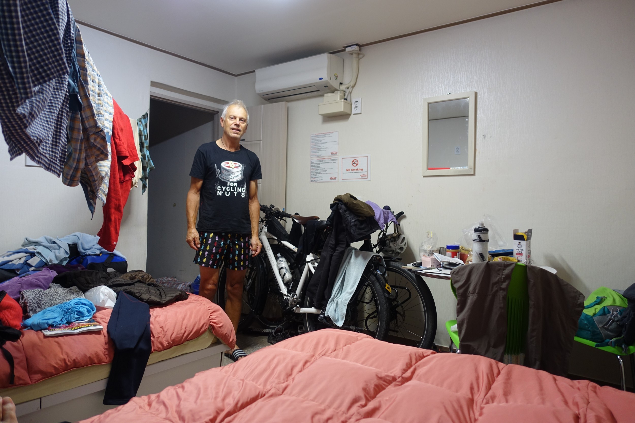

Most of the signage along the trail was in Korean, so we had no idea what towns we were passing or what might be a point of interest. Google Translate wasn’t very good at identifying Hangul characters displayed in colour, on wooden boards. Google Maps didn’t show all of the towns. We learned that the Koreans use the Naver Navigation App, that has places in Korean and English. The bicycle trails are also marked on Naver. We did download the Naver App, but the problem for us was that Naver needs data. We hadn’t purchased a Tourist CIM Card when we were in Seoul, as it cost about $50, (we should have purchased this) and at that time we were planning to be in Korea for only two weeks, and we also knew that in cities, free Wifi was available at most cafes, restaurants and sometimes public spots. We managed to find accommodation by using the Maps.me App with South Korea (downloaded when we had free Wifi). Searching under the category Hotels would also display Motels, as a blue dot, and we would head in their direction. Often the trail bypassed towns so sometimes it meant just crossing the river to find accommodation and food. As a couple we found staying at ‘love motels’ very reasonably priced (and sometimes a bit quirky) but they were clean, and in addition to the bed were often furnished with a table and chairs, kettle provided so we could fix our own breakfast or heat noodles, and had an en-suite so they were very suitable. With underfloor heating a feature of the Korean lifestyle, staying overnight indoors was sometimes too warm for us, but really who’s complaining. An unexpected bonus was we could sometimes talk to other people, rather than just be the two of us camping in isolation. One day we were invited to join the motel manager as she attended morning prayers at a Buddhist Temple, high in the mountains, usually a two hour hike. This resulted in us taking tea, made from ginger flowers, with the resident Monk, and were each given a gift of a Korean face mask and bead bracelet. Another time we had an enthusiast manager invite a local member of the cycling association to meet us and he gave us some good tips.


We found Koreans to be very generous as has already been mentioned, or occasionally we were given a piece of fruit by other cyclists or walkers. We also spent an evening as guests in a Korean home, in response to a generous invitation. Our knowledge of the Korean language is ziltch and outside large cities we often didn’t find English speakers, but we got by with hand gestures, Google Translate App downloaded, and pointing to pictures on the wall in restaurants. We were often asked ‘how old are you’ and found this to be in relation to Confucianism and respecting elders. While we found Korean people always respectful, additional respect was given to people older than themselves. This could be as simple as serving the eldest person first.


The trail surface was always sealed so easy riding in that respect. Most of the kilometres were flat, however many times each day there were the 7% ups and downs to access the top of a stop-bank or drop under a bridge. Korea certainly knows how to produce hills and threw a few into the mix. For us Day 3 had some road sections and with 234m ascent we gave our legs a bit more to do. Our first major climbing experience appeared on Day 5. There were two significant climbs that day, although the gradient and distance covered on the first section wasn’t too bad. The second climb was 5km of between 6-10%. We completed this ascent at the end of the day and night had fallen by the time we got to Ihwaryeong Rest Area checkpoint. We had a very cold, winding, downhill ride to Mungyeong in complete darkness. A good test for our lights. Day 6 gave us a couple of short sharp climbs and a memorable one with an unexpected 26% gradient (short and sharp) that was absolutely impossible to ride on loaded bikes. Climbs continued to feature, for us, between Daegu and Susan-Ri. After Daegu we were advised to check the trail map for when squiggles appeared, as this would identify a hilly section, and studying the map usually showed a section of road that offered an alternative, avoided the climbs and later linked to the trail. We didn’t heed this advice at the first squiggling we came across and ended up pushing 300 metres up a 15-20% incline. Where possible squiggling lines were avoided after that. There were a couple of big unavoidable climbs after Hajeong. The first included an 18% incline and the second appeared to go straight up for the short distance we could see, so we started pushing. The climb then eased to between 12-16% over 2 kilometres!


The trail infrastructure continued to amaze us. Toilet facilities were placed along the trail at regular intervals. Most were clean with toilet paper and hand washing facilities; some with music. A few toilets were squat over, porcelain pans over long-drops; usually in isolated places. Pagodas could usually be found at summits of hills or on a riverbend that had an outlook that was aesthetically pleasing; these offered shelter and lunch spots. Stainless steel fencing, extended for kilometres, even in isolated places whenever it was possible that someone might drop off the trail, if they weren’t paying attention. We were fascinated by the use of stainless steel in South Korea, for fencing, bollards, drink tumblers and even chopsticks (that I found to be very slippery) but the shiny steel gave a clean appearance.


Safety signs were prolific, in fact it was obvious the trail was treated the same as any highway with warnings as appropriate for such things as trail works, steep gradients, possibility of falling if leaving the trail (even though the boundary was usually fenced if there was any likelihood of a fall injury)!
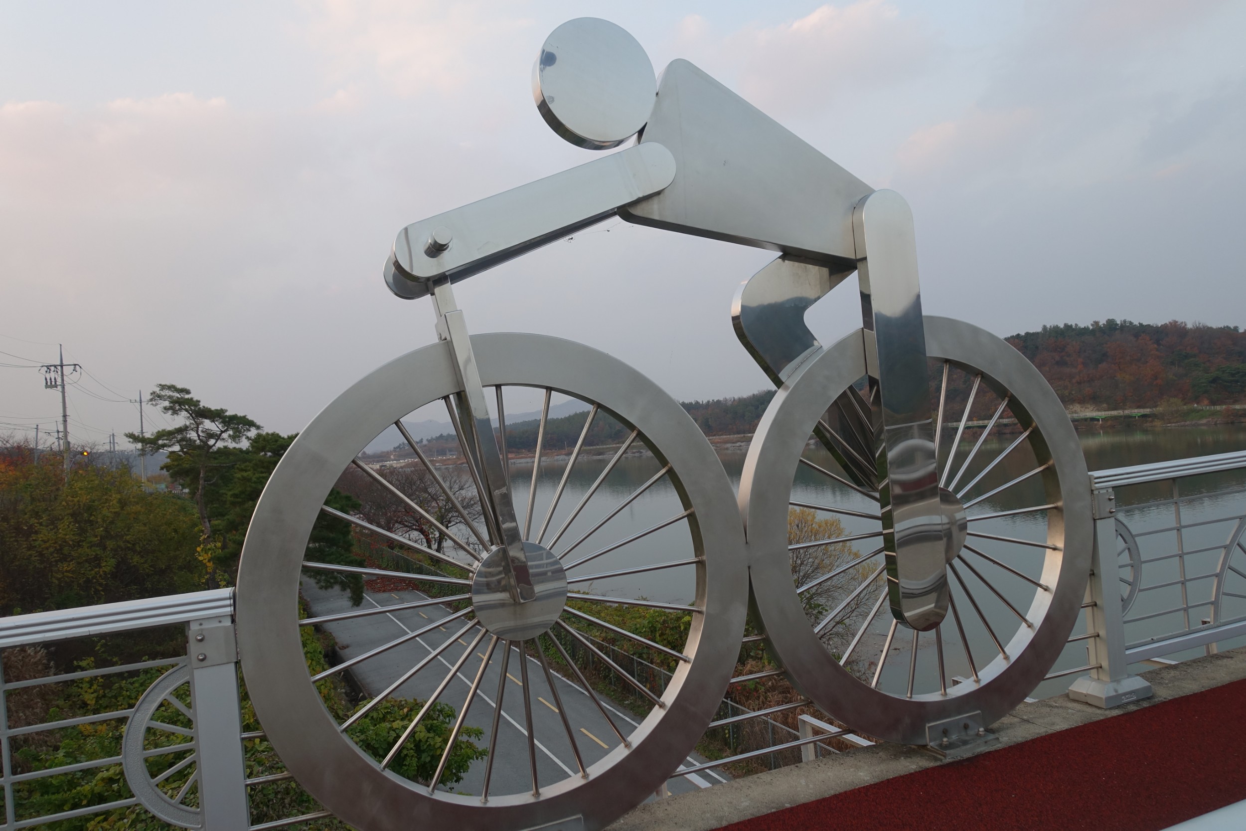
The theme of the trails was understandably bicycling. There were occasional art works, seats, even a toilet block, and many kilometres of stainless steel fencing that embraced cycling. At Dongam-dong there is the Sangju Bicycle Museum.


We never tired of the scenery. It was autumn so some days were hazy all day, some were thick fog until late morning then clear in the afternoon, some were sunny with clear visibility and we had one day of stubborn rain so we called it off early. We were surprised that there was never anyone using the river. There are many weirs so there can be no through traffic such as Europe’s industrial waterways, but we never saw a small boat of any kind, nor fishermen on the riverside.


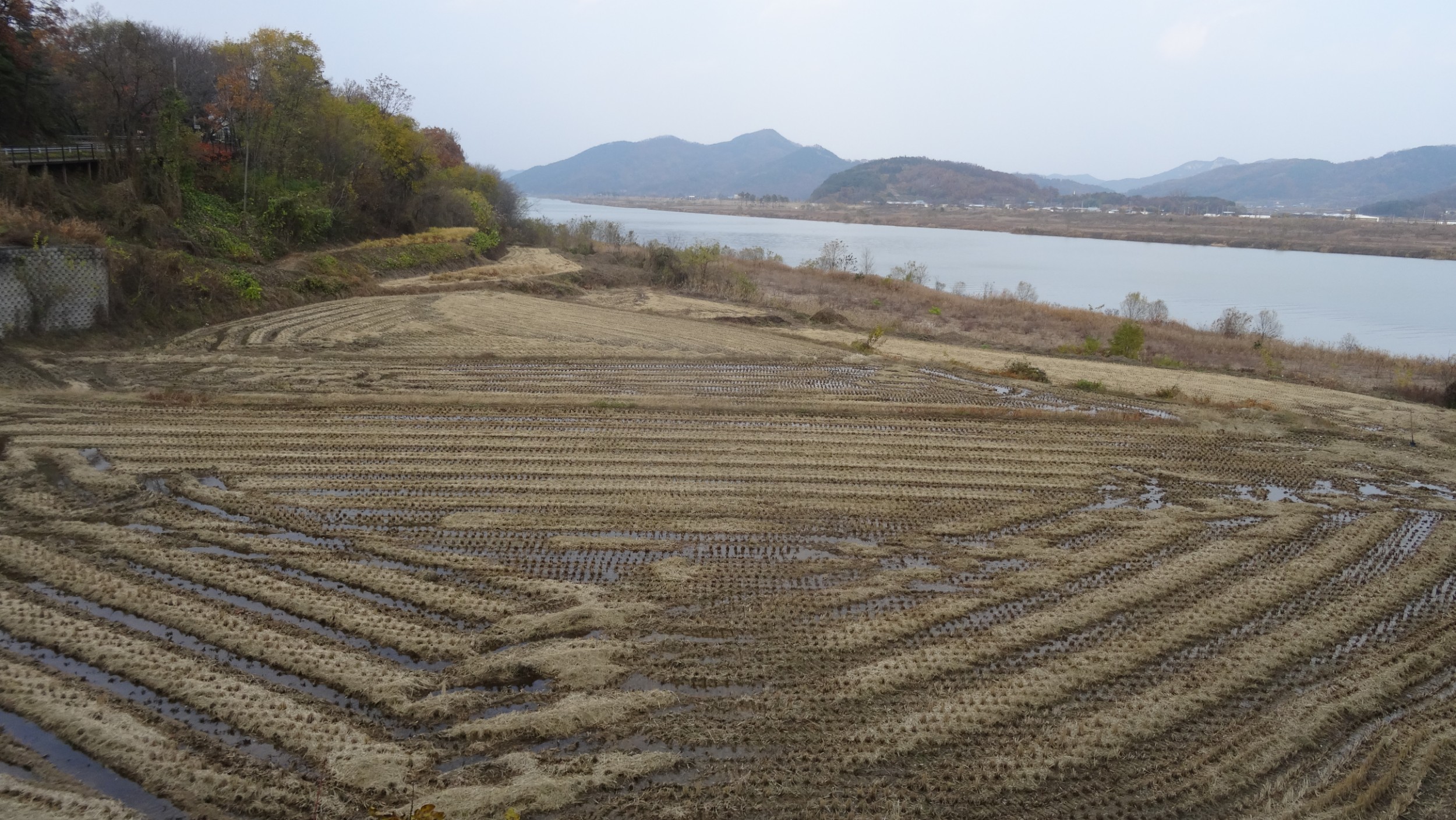
The land beside the river had various uses, with walking tracks through wetlands, and sports fields being the most common near cities. Park Golf seemed popular, and it was at these up-sized putting greens that we saw large numbers of people. Adult outdoor gym equipment parks were plentiful, and occasionally we saw people making use of them. In rural areas there were kilometres of crops: turnips, onions and garlic, with daikon radishes and cabbages being harvested. Rice fields extended for kilometres; at this time the grain had been harvested and now the stalks were being cut and bailed in white plastic rolls. Greenhouses covered in taut plastic would stretch as far as the eye could see and change the view to one similar to glistening ripples of snow moguls.


The mountains were often distant silhouettes, blurred by the weather, although we did get up close and personal with mountains, mid ride. There was always a cluster of high rise apartments in sight. We had no idea that South Korean urban populations would be so dense. Most people lived in an apartment in a high rise building that had a large number on the side. Groups of these buildings were called villages, and a number of villages formed a city. Closer to Busan we came across a few rural villages with clusters of small houses.


Mornings were sometimes very cold and we did make use of the face masks we were given. With the mask and a buff under our helmets we were pretty toasty but as the day warmed we removed these and other layers of clothing. We found it amusing that local cyclists, even when the temperature increased, would remain covered from head to toe in face mask, puffer jacket and long pants and imagined ourselves to be in a sweating lather if it was us riding in that attire. Sometimes we became aware of an approaching cyclist because we could hear music blasting from a speaker, surprisingly usually western songs. We also came across this sharing of music when we did some hikes, that we found annoying or not, depending on personal taste.
This is possibly a generalisation, but it seemed that Korean cyclists did not have the knowledge, or the equipment to repair a puncture. On three occasions Nev stopped and fixed punctures, the person not having the means to repair, and many other cyclists would have also gone passed the person pushing their bike, and had not offered assistance.

We very rarely rode on a street in South Korea, but when we did we rode defensively, as we would anywhere, but we didn’t feel confident that drivers would be looking out for riders, as so many cyclists ride on trails away from traffic. Apart from difficulty choosing food at some restaurants, language wasn’t an issue. We did find getting cash was a problem at times. A lot of ATMs wouldn’t accept a foreign card, and while 7/11 stores ATMs were okay they would only dispense a maximum 100,000 won, with high fees.

Four Rivers Trail completed
Overall we enjoyed our 4 Rivers experience and decided to spend more time in South Korea, riding Seomjingan and Yeongsangang Rivers Trail (you can read about that ride here) and then riding the circumference of Jeju Island (you can read about that here).

RIDING ITINERARY
Day 1: 47km: Ara Waterway, Hangang River to Seoul, stayed at Kimchee Hostel
Day sightseeing in Seoul
Day 2: 74km: Seoul to Yangpyeong-gun; Free camp
Day 3: 76km: Yangpyeong-gun to ; Jocheon-ri; Free camp
Day 4: 30km; Jocheon-ri, to Mokaeng-dong; Damien Motel (shorter day because of torrential rain)
Day 5: 76.km, 914m ascent; Mokaeng-dong to Mungyeong; Sky Motel
Day 6: 77km, 357m ascent; Mungyeong to Nakdong-ri; Phoenix Motel,
Day 7: 87.8km, 246m ascent; Nakdong-ri to Daegu; Hosted at a Warmshowers home
Day 8: 70.5km, 374m ascent; Daegu to Hapjeon on outskirts of Angjin-ri
Day 9: 63.5km, 519m ascent; Susan-ri, Princess Hours Motel
Day 10: 75.4km; to final check-point at Nakdonggang Estuary Park, then to our accommodation in Busan