Taiwan: Cycling South from Taroko Gorge to Kenting via the East Rift Valley
Louise George
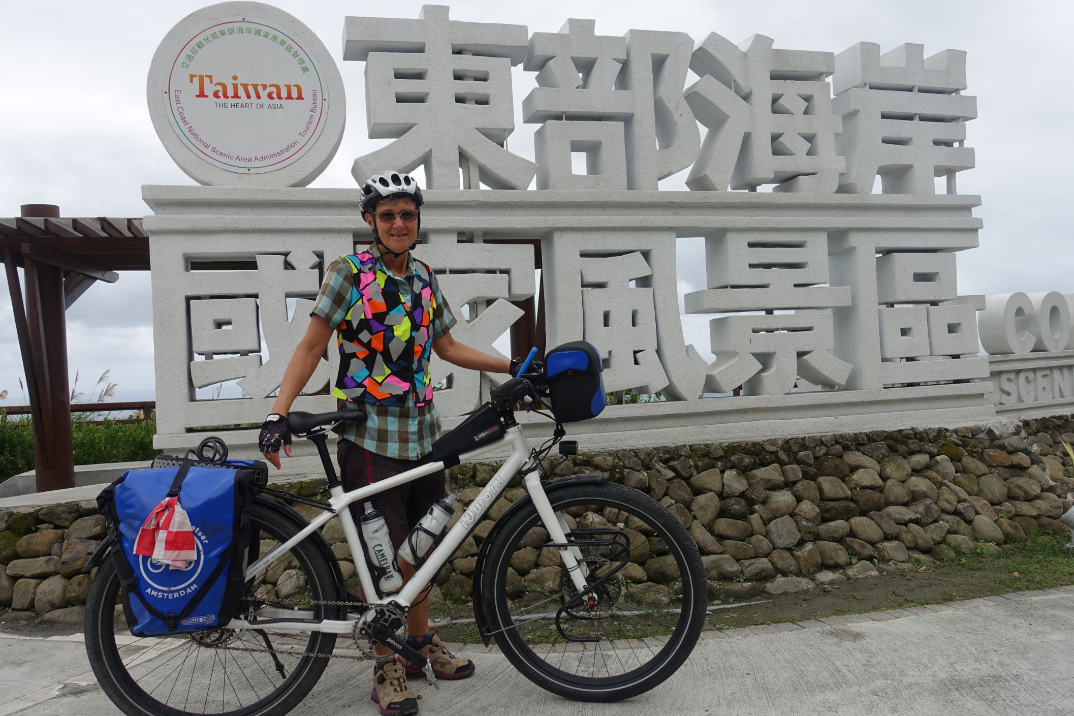
Although there is a signed ‘Cycle Route 1’, a circuit of Taiwan that can be completed in 5 to 12 days, and we have more time than that, the entire route doesn’t really appeal to us as we’ve read that the western side of the island is very industrial, and the north will likely receive monsoonal rains at this time. We are riding in December. We’ve decided to have a good look at the East and Southern areas, and take advantage of public transport to link sections if we need to.
We’ve decided to give up on camping for now. We’ve come from South Korean autumn, where we found it too cold for camping, and continuing to lug camping gear seems superfluous to requirements now in Taiwan and later in the Philippines, that will be the next country we travel in. Neither Taiwan nor the Philippines seem too expensive for accommodation so we chose to take a more comfortable option and posted the small front panniers and all of the camping equipment to New Zealand where we figured it might next come in handy.

We´d had an enjoyable couple of days exploring Taipei; but keen to get out of the metropolis
Our first section by train is from Taipei to Hualien. Bikes are allowed to be taken on trains, in a specific carriage, however no bikes are allowed on a station platform. Anyone cycle touring would know that the easiest way to get a loaded bike to within cooee of a train carriage, would be to wheel the bike, right up to where the carriage would stop, and then package the bike to meet the travel requirements. We were sure that officials would understand this, so arrived at the lift used for transferring luggage to the platform, armed with tools, bags and tape that would eventually conjure our bicycles into a form such that they would no longer be recognised as such offending items. We rang the bell, as the lift had a ‘lock’, that summoned the official, who made it clear she would not let the bikes on to the platform. We soon had a group of curious passersby keen to interpret our request and concerns, but to no avail. Rules are rules! We set about dismantling and packaging the bikes, beside the lift with our audience taking an active interest in the proceedings, us, and our travels to date. The inquisitiveness slowed us a bit, and by the time we completed the job and got approval to use the lift, we were getting uncomfortably close to departure time, and trains wait for no-one! Finally we arrived at the platform, but outside where carriage 8 would stop. We then had to run relays of heavy, awkward bikes, and then panniers and handlebar bags, what seemed like 500 metres down to where carriage one was identified on the platform concrete. By the time we, and the bikes boarded, we were exhausted.
Hualien to Xiulin near Taroko Gorge 30km


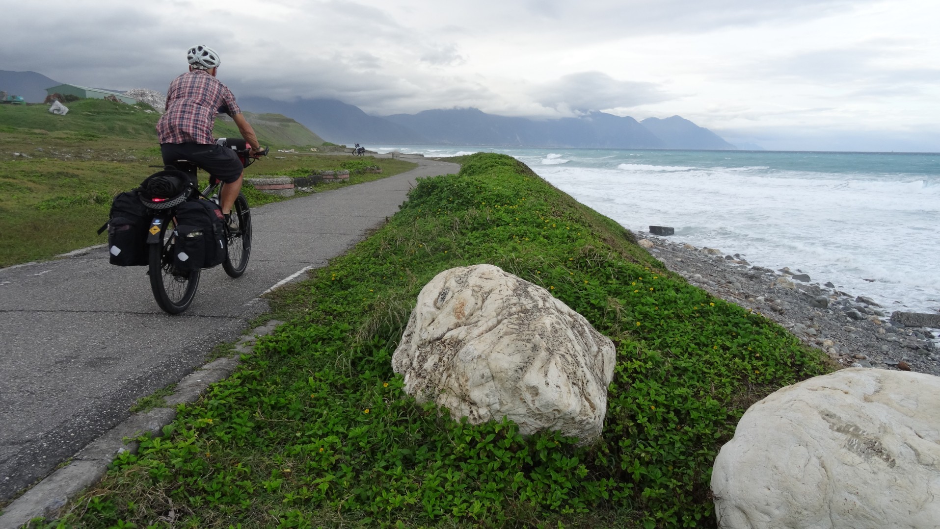
Hualien was a small station and we easily alighted and got the bikes ready to ride. Before setting off, for what we expected would be about 16 kilometres to our guesthouse, we enjoyed a Railway Box lunch and Bubble Tea near the station. We knew we would be following the coast and that there was a cycle route to follow, so we headed for the ocean, stopping briefly at the roadside to glimpse Hualien Railway Culture Park and Tungching Temple. Finally beyond the city, the coastline reminded us of the West Coast of New Zealand as the shore was of dark weathered stones and huge waves pounded the coast. On dusk we arrived at an area where many tourists were milling about and watching the ocean. There were also a couple of food stalls so we stopped to eat baked sweet potato. We couldn’t figure out what people were waiting for, but noticed fishnets on the ocean and wondered if they were about to be hauled in. By this point we had ridden well beyond 16 kilometres and couldn’t understand why we still had such a long way to go. We checked the cycle brochure and found we had headed south out of the city and hit the coast lower than we needed to, then by hugging the coast had skirted around a headland, clearly quite a few extra kilometres! Darkness followed us into the guesthouse. We were shown our room and the kitchen where we could prepare our dinner.

We had been told what time breakfast would be ready and duly arrived outside the kitchen on time. Nothing appeared to be ready but our host ushered us into his truck and drove us out the gate, across the stone beach to the ocean shore where a long table and chairs were set up. We were left to enjoy the unique beach setting and then he returned with a huge array of food, with other guests following on foot behind his vehicle.
Taroko Gorge, from Xiulin and return 50.53 km, 635 m ascent

Taroko Gorge was an 18 kilometre gradual incline on a narrow winding road with spectacular marble canyon walls hemming in the Liwu River. Cut by the Japanese (using Taroko labour) the Zhongbu Cross Country Highway was to extract natural resources and access to control the mountain tribes. Just as well traffic was light, because the width of the occasional tour bus, took up all of the road. We took our time, stopping for many photos, to climb up to shrines and temples and just take in the spectacle of the road.


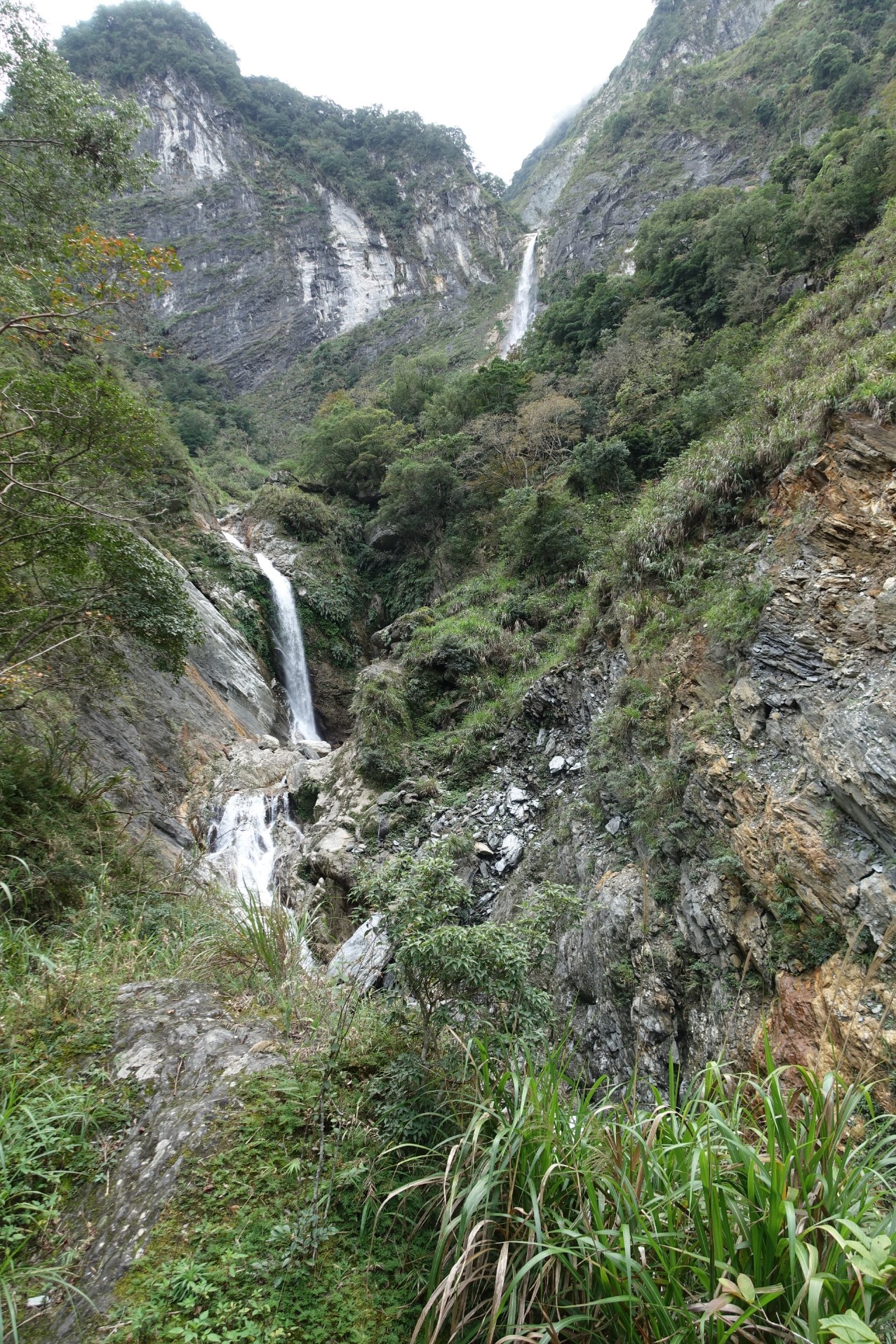
We ate lunch at the only village, Tien-hsiang, and then onward and upwards continued our cycling, but not for too long. We parked the bikes and walked in to the Baiyang Trail that surprisingly started with an entrance tunnel of 380 metres.
The walk was a 4km round trip that took in the scenic view of Baiyang Falls and finished with us wading through a dark tunnel to the Water Curtain that was sheets of water escaping through a rock fissure. The crack occurred when digging of the cave accidentally pierced the stream bed above the cave. The tunnels were built with a view to creating a power source that would have blocked the ecosystem of the Taroko Gorge. Fortunately public pressure caused the power plant concept to be abandoned.

Xiulin To Guangfu 80 km, 450 m ascent
We rode through Banana plantations before joining the main road to Hualien, and yes the direct route was exactly 16km. We easily added another 6 kilometres looking for an ATM! The narrow roads, we took on the outskirts of Hualien took us through a farming area where a variety of produce was grown, such as Taro, sweet potato, and onions. We followed a canal, on a path that must have been a footpath as it was narrow and negotiating steps was involved.

Lake Liyu marked the entrance to the East Rift Valley where Coastal Mountains rose on our left, and Central Mountains to the right.
Rain fell heavily not long after we left the lake. There was an open garage close to the road so we ducked in. The man who’s garage we occupied pulled up a chair for each of us and we sat comfortably until the rain stopped. The man was drying very small chips of wood that I think was camphor.
It was getting dark and we couldn’t find our accommodation. We had ridden through Guangfu and had already passed through, turned around and come back to another small village. We showed a group of people sitting outside a house where we wanted to go. One lady indicated for us to follow her on her motorscooter. I was riding as fast as I could and felt anxious every time the motorscooter and Nev disappeared around a corner. Eventually we arrived at the Guesthouse (that incidentally was on the wrong road on Google Maps). We were quite a long way out of town and dinner here wasn’t an option. Thankfully our host spoke English. We took him up on his offer to drive us to town, and then he ordered our meal, left us to enjoy dinner and returned later to take us back to our room.
Guangfu to Yuli 77 km, including a detour up to the Walami Trail 747 m ascent
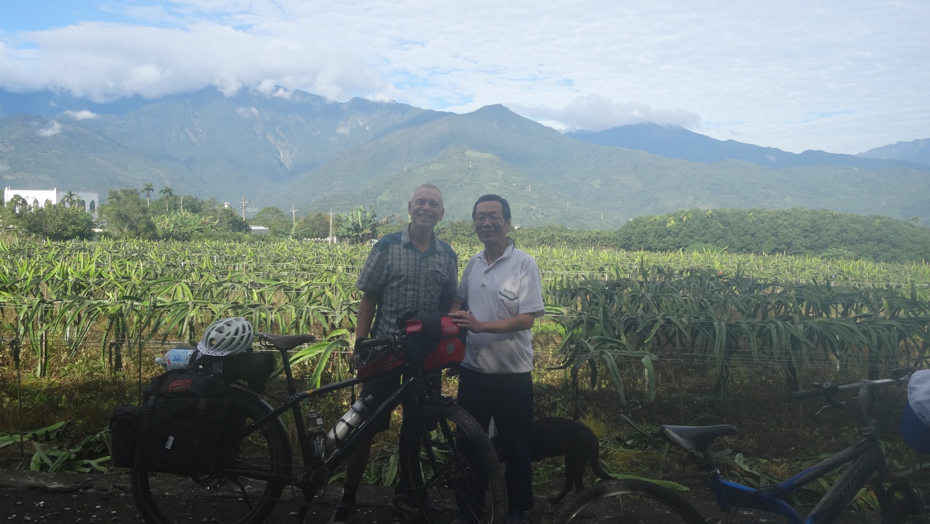
Our host told us his wife taught him how to cook when, following his retirement, he took on the guesthouse. She taught him well. There was an enormous breakfast laid before us. We ate as much as we could, and then on leaving we were given some bananas, a loaf of bread, a huge vegetable dumpling, and cumquats to take away. Our host also wanted to be sure we got to route 193 as he had recommended it to be the most scenic, so he rode with us. Ahead of us actually; and flat out. We had trouble keeping up. We were parting ways near a dragon fruit plantation that had been recently harvested. Next thing he was back with us, passing a couple of dragon fruit to stuff in our already full panniers.
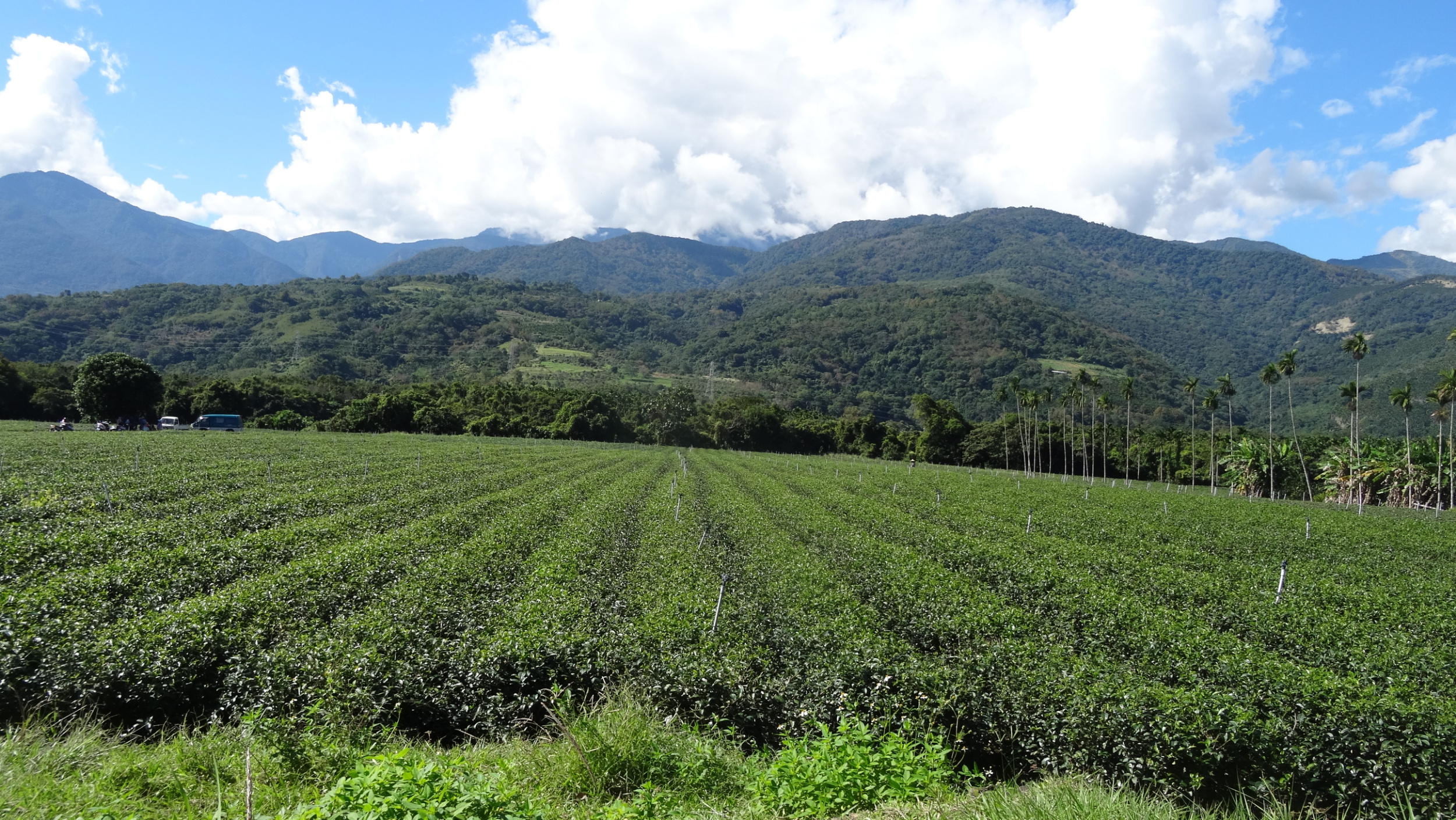
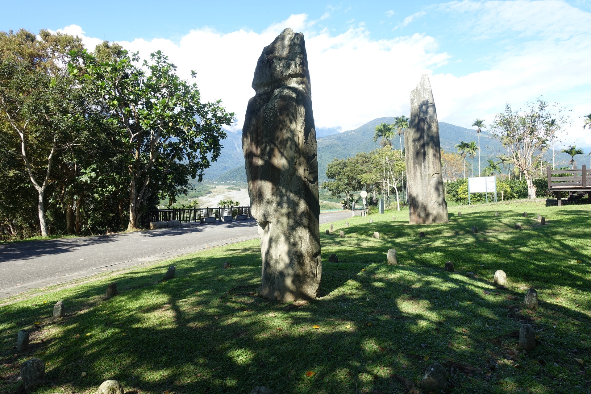
Route 193 was rather hilly, but very picturesque, with plantations of coconut, pineapple, rice, dragon fruit, and a view across to the mountains on the opposite side of the East Rift Valley. We dropped into the town of Ruisui for coffee and then continued on Route 9 so we could see the Wuhe Tea Plantation (although we didn’t stop there) and the Tropic of Cancer Marker Park so we could get a photo to mark the milestone. Next stop was at Satokoay Stone Pillars that are a ruin of the late Stone Age of Beinan Culture; a holy place where ancestors spirits live.

Yuli was to be our home for the night and we arrived at midday, too early to check-in, so rather than dumping our gear as we would have liked as we knew we had a long climb ahead of us, we continued with loaded bikes. Our effort took us uphill, past Nan’an Waterfall to the start of the Walami Trail in Yushan National Park. There was a tour bus and a few vehicles in the car park at the top of the climb, and we were greeted by applause and a cheering squad of strangers as we arrived at the highest point; rather a delightful way for two very sweat-drenched cyclists to finish a challenging ride.

Welcoming committee!
We didn't have the permit, nor the time needed to walk the trail, as we only had 30 minutes before we would need to start our ride back down. We walked the first kilometre to the swing bridge, passed warning signs about bears, snakes and wasps, through pretty forest. Back out to the road we walked with some people from the tour group, who shared their baked sweet potatoes with us, and then helped us by phoning the number to our accommodation and arranging a time for us to meet our host. The downhill ride was a ‘blast’ and a great way to finish another long day.


Yuli to Dulan 81.8 km, 681 m ascent
There are three ways to exit the East Rift Valley. Either continue on south and eventually arrive at the coast at Taitung or take either of two routes across the mountains in an easterly direction to the coast. We chose Highway 30, that would take us over the mountains and then give us a longer ride along the coast. We left Yuli crossing the river on a bridge for cyclists and then following the Yufi Cycle Trail. The recently harvested rice field on our right would soon be prepared for rapeseed that would paint the lowlands yellow in Spring. Papaya and Bananas would ripen on our left. The areas we have ridden in to date have had a high indigenous population. Their farming methods has changed over time from a scattered burn approach of farming millet to the production of fields of maize, and now of rice. Traditionally they sing in 8 part harmony, to make the gods happy and achieve the success of the crops.


For now we weren’t concentrating on our course and should have ducked out to the road a few kilometres back. An about turn, took us back to a turn off to Highway 30. We then passed Antong Hot Spring area and straight into the climb. It wasn’t as bad as I had anticipated; 4 kilometres of steady effort and then the road plateaued.


A 2660 metre long tunnel took the sting out of the mountain crossing. On exiting the tunnel we had cloud hanging low, cooling us with water droplets and obliterating the Liushishi mountain tops (In Spring the slops are covered in Day Lily blooms).


The Pacific Ocean spread before us. A wonderful downhill dropped us beside the coast, where a very strong wind had whipped the waves into a frenzy, but to our advantage that strength would blow favourably on our backs. We stopped at Sanxiantai Bridge and dragged our weary legs up and down the eight arches of the dragon structure, that to us seemed an incongruent link between the mainland and the ocean-eroded volcanic islands. The wind was so strong it was an effort to stay upright as we walked around the island.

Sanxiantai Bridge
We decided to take advantage of the wind and with only two hours of daylight remaining, smashed out the 36 kilometres to Dulan, a small town with a reputation for an arts scene and good food. It didnt take long to find the Sintung Sugar Factory Culture Park, and less time for us to take in the ´vibe´ there. It seemed more suitable as a venue for younger people to enjoy music, and buy food and crafts from ´pop-up´ stall.s
Dulan to Taitung 26.4 km, 118 m ascent
Because we have a short riding day to Taitung we spent the morning at Dulan with a walk to the beach, evidently a popular surf beach, and a stop for Bubble Tea that we have become addicted to. We stopped just out of town to join other tourists at the phenomena of ´Water Running Up´ but were more intrigued to sample some of the local custard apple grown with care, in local orchards.


Our arrival at Taitung was in time for lunch in the city then it was five kilometres to our accommodation near the railway station and close to the eastern exit from the East Rift Valley. We’ve had an amazing type of accommodation while in Taiwan. Lin Yuan Bicycle Homestay is one level of a private town-house, there is no restaurant nor cooking facilities, but breakfast is included, our room is large and we are given access to filtered water and to the laundry. After a rest and clothes washing, we set off on foot looking for a restaurant. Eventually we find a Railway Box restaurant that closes in 15 minutes. These ‘meals-in-a-box’ are created for passengers to take on their train journey and we have found them to be very adequate meals. They typically resemble a Japanese Bento Box and almost always include a combination of protein: pork, chicken, mackerel and other items such as tofu, pickles, a vegetable and an egg that is black edged because it has been marinated in soy, all served over a bed of rice.
Taitung 26 km
We had planned to have a day off the bikes but being out in the suburbs, cycling is the easiest way to get around. We started the day at the eastern head of the East Rift Valley to see the Badlands.

Next was a ride through the city centre in a south-easterly direction to the National Museum of Prehistory that gave interesting displays of the geographical formation of the island of Taiwan, the development of Homosapiens through the ages, including the human species in Taiwan, and the Taiwanese First Nation people´s rights.
Taitung to Dawu 62 km, 456 m ascent
We set out from Taitung not knowing where we would be staying for the night. I’d had a quick look on Maps.me and there appeared to be little accommodation available on the coast, however we didn’t know how far we would ride so took the chance of booking later. Probably not so wise as it was a Saturday and once we were riding the coast road south, became aware of how many tourists buses were on the road. The coast road was a four lane highway. We were riding on the right so, apart from snatches of distant sea views, didn’t get to see the coast. We did however see the built up highway ahead, as it climbed up and over headlands. Our road shoulder was very wide so we felt comfortable in the traffic, but later there were long sections of road works. A new high speed railway was being built on pillars above the road, and the work halted traffic for long periods, alternating between north and southbound.

One hundred tourists can’t be wrong so when we saw a number of vehicles, in what seemed like the middle of nowhere, we parked and walked up a switchback track to an area that looked like it had previously been a railway station. There were a couple of food stalls but apart from that we had no idea why we were there, amongst at least 100 other people milling around.
A little later at a 7/11 coffee stop Nev had access to 1-minute WiFi and established there was no accommodation available on our route. We wondered about what obstacles we might face if we found a secluded spot and slept ´bivvy-style´ in our bike bags tonight. Whenever we have been in difficult circumstances like this, something good has happened so I wasn’t too worried. Cycling routes are well signposted in Taiwan and there are designated cycling Stations, with distances between them signposted along the route. The cycling stations are usually at Railway or Police Stations. We haven’t used them yet but spoke to another cyclist who did spend the night at a Police Station, so that is always another option.
When we arrived in Dawu we noticed a sign with a snowflake on it, that we assumed meant air-conditioning, therefore a room. While crossing to that building entrance, we noticed another shop-front with pictures on the window indicating a Bike Hostel. Yes, they had a room so we settled in. A man at the seafood restaurant next door spoke good English so we were able to order prawn fried-rice, seafood omelette, cabbage, and Day-Lily Soup, in quantities that filled our hungry bellies.
Dawu to Kenting 74.5 km, 717 m ascent
We’re still carrying muesli, so that, with fruit and yoghurt was a solid start to the day. After eight kilometres our course took us inland into a twelve kilometre climb to cross the Central Mountains. Stunning views of forest clad mountains diverted our attention from the climbing task. We saw one monkey, but crashing branches indicated the presence of others leaving the roadside. Way below at the bottom of the valley an almost finished section of the high-speed railway snaked through the jungle.


We turned onto the 199 road in a south westerly direction and not long into our descent came across an Australian family of two adults and three children, riding up. We stopped for a very long chat. They’d had the bagging bikes (5) for trains issue and also experienced the northern monsoons and now rapidly escaping the industrial east. I could only admire their fortitude, and I expect infinite patience, to make their first experience of cycle touring as a family, a success.


Our descent took us through tribal villages that had buildings decorated with bright murals and statues that depicted the indigenous way of life.
Eventually, on the outskirts of Checheng, the course became flat, the landscape more densely populated and the Chinese influence more obvious.

With the wind light today, we were soon on the South-west coast at Kenting. What a difference a day makes! Our accommodation faced a golden sand beach (no swimming allowed because of the undertow) and in the evening the Kenting night market came to life, with food, cocktail and side-show stalls, and a constant stream of Asian tourists dawdling passed these on each side of the main road.
Kenting
Today was to be a day off. We’ve been travelling by bicycle for almost six months, just clicked over 7000 kilometres and to be honest I’m feeling physically weary and getting tired of the cycle touring routine. Maybe I’m feeling a bit melancholic because this is the time of the end-of-year wind up for Australia and the lead up to the Holiday Season. I know I have the luck of a perpetual holiday but it’s losing its glamour and I’d dearly love a hug with my children, the company of friends, and a touch of a normal life. So we decided this was to be a proper day off. No cycling! By 3 in the afternoon I was feeling jittery so we headed out on the bikes and rode uphill, 4 kilometres to Kenting Forest Park, just to take in the view and then enjoy a lovely downhill back to base.
Kenting to Taiwan’s southernmost point and return 22.5 km, 322 m ascent
We came to the south of Taiwan to cycle to the southernmost point and today we intended achieving that. We’d mapped a short 21 kilometre loop course from Kenting. With blue skies, and a late breakfast of too many calories providing energy to burn, we expected a couple of hours of pleasant riding. We passed a couple of pretty beaches but our view of the coast was usually hidden by shrubbery that thankfully offered some protection from the wind. By the time we got to the southernmost point we could barely stand to view the ocean.


The wind whipped at us so erratically, as we rode north on the high western cliff side of the peninsula, that I stopped a couple of times and walked, for fear of being blown into the path of a vehicle. Later there was no traffic on the narrow, sometimes gravel, minor road that we took back to the east, but the wind gusts continued to thrash us unpredictably, and it was with a feeling of ‘well that was a short but epic ride’ that we returned the bikes to the security of the foyer at our accommodation. Tomorrow we ride north with headwinds forecast.
Kenting to Kaohsiung 108.68 km 343 m ascent
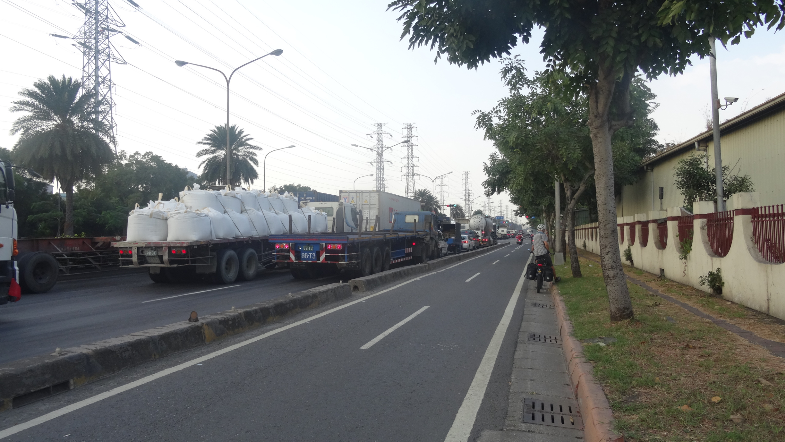
We planned and achieved an early start as we wanted to get to Kaohsiung in one day. We knew it would be a flat ride but not sure how much of a handicap the wind would be. We started with the wind blustering sideways, but not too strong. At first we passed through the same flat route we had come south on, passing the paintball venues, and about six go-kart tracks; one even with miniature diggers and a mound of dirt suitably placed for removal. We followed a dual carriageway the entire route, with a breakfast break at McDonalds. Once we were in the lee of the mountains that stretched across the entire peninsula from west to east, we hugged the coast, sheltered from the wind. Later the route was signposted as a scenic area, and maybe it would have been if we had detoured to a beach, but we were riding in urban sprawl interspersed with orchards of mango, dragon fruit, and the wax apples that were currently in season, and the only fruits being sold at roadside stalls. Other stalls sold only onions so my guess was these were also in season. We crossed the very wide bridge over the shingle flats of the Kaoping River and arrived in an industrial zone of Kaohsiung. Many steel works and other industrial buildings lined the road and even though we had a designated cycle lane we were constantly stopping at traffic lights for trucks to turn across our path, into entrance ways of factories.

Kaohsiung was our last cycle destination. From here the bikes were bagged and taken by train with us to Taipei where we had a final stint riding from the railway station to a suburb a few kilometres from the airport. Our evening was spent wrapping the bikes in Gladwrap, with cardboard protecting the frame, and finally bagged in the IDWorx cover bags that Nev had continued to carry. Duck tape secured the packages.
Next stop Philippines.